

Added value services

Cartography and spatial topography
Our core business, precisely. We developed throughout the existence of our company, methods of elaborated cartographic production. These methods, adapted to every situation in any point of the globe, allow to develop digital cards from multiple sources of images: optical Images in high and very high resolution, radar images, night thermal images. Our knowledge allows you to solve practically all the situations for your drafts, on the 5 continents.

Image processing
We made of the processing of spatial and air images our speciality. We are able to exploit the observation images of any satellite to extract thematic information. We have had to answer precise thematics to use the best type of image, adapted to a situation or a specific application with the best adapted method of treatment(processing). More recently we began to exploit(run) treatments(processings) specific to the radar images and to the images of thermal cameras
Spatial photogrammetry
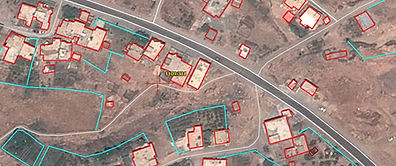
The collection of digital three dimension data became essential for the constitution of precise maps that we use every day. The technique of acquisition and input of these data depends on the capacity to manage at best the sources of three-dimensional data at our disposal. These sources considerably developed from satellite missions these last years. The acquisition of such data is made possible in any point of the globle up to the scale of 1:5000

Thematic analysis
The thematic analysis is inherent to the collection of ground information from distant sources. It allows to interpret and to analyze situations better for a better knowledge of a particular context. We have had to multiply studies that our customers entrusted us with in very specific contexts. These studies are led in very diverse places and climates; so we had to work in equatorial regions as well as arctic and temperate zones, on a variety of subjects.