

Applications
Natural disaster management
Our business naturally leads us to produce factual data to understand and better manage the events that lead to large-scale losses on our activities, in the city as well as in the countryside, by the sea and in the mountains.
Our expertise in these techniques allows us to understand and prevent, to a certain extent, the devastating instantaneous or medium-term effects of major natural accidents such as volcanic eruptions, landslides, risks of sub-glacial dam failures, combined effects of large tides with tropical storms or at our mid-latitudes; our remote sensing technologies help us to do this, by studying, for example, the speed of movement of glaciers using interferometric radar imaging techniques.


Land use planning, urban planning, facilities
The mapping of the development of territories has always been part of our activities
Since the beginning, our team has had the experience of the vision of the evolution of urban landscapes projected on the master plans of development and urbanism that draw the cities of tomorrow, the use of images and production techniques to manage airport and railway infrastructures... Our job consists precisely in helping on these anticipations with the cartographic tools best adapted to the study of the territories and their mutations, for the stakes for the benefit of the future generations
Environment, forestry, water resources management and sustainable development
Managing environmental issues is a key issue for our shared habitat subject to the vagaries of climate change
Earth observation and applied techniques of information knowledge have become essential tools to understand drastic evolutions and better apprehend their medium and long term repercussions on our environment. The stakes on the preservation and repopulation of forests, as well as the preservation of wetlands and bio-diversity, the management of water resources and hydrology in watersheds, and the optimization of renewable energy production infrastructure locations are essential issues. The technologies that we master thanks to space and airborne imagery are tools that can contribute to the study of these issues.


Geology and mining exploration, fossil fuels
Earth sciences are a key area for mineral resource management and fossil fuels
Satellite and aerial hyperspectral images help in prospecting by providing knowledge of the mineralogical nature of outcropping soils. It is possible to know with precision the nature of soils by classifying them according to their spectral signature, characteristic of their mineralogical composition. Spatial mapping is also used in structural geology to understand the formations and series that will be as many clues for the implementation of more advanced geophysical prospecting campaigns. Our offer of optical and radar satellite imagery gives a new perspective to contribute to the implementation of such studies.
Agriculture
Our common food, the concern of providing for the populations of emerging countries is at the heart of our concerns
The techniques we have implemented over time are proven and recently augmented with the latest technical advances, such as object-oriented classification and artificial intelligence algorithms, to understand agricultural production patterns and our subsequent food capacity. Here again, the expertise of the combined use of high and very high resolution satellite imagery, but also hyperspectral aerial imagery to analyze in detail the variations of adaptability of a type of agricultural sector such as the behavior of the vineyard, for example, or the substitution of cereal species to the evolution of the climate, make spatial mapping an essential tool for this major issue for our populations.


Defense and Homeland Security
In a world more than ever in tension, in order to preserve peace we must anticipate and bear witness to the events we witness.
The use of very high resolution space imagery in the visible and radar domains are key tools to know the inputs of the regions of our world that are in tension. They testify and help the actors of the diplomatic world to try to reach and solve conflicts, even in regions made impracticable or inaccessible. Our know-how makes possible studies in any point of the globe and guarantees reliability and standards of information essential to the experts in charge of analyzing a context to report in an operational context.
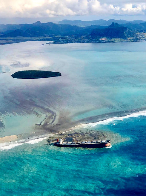
Maritime surveillance
The detection of navigation anomalies, the fight against illegal degassing and major maritime pollution incidents have become essential necessities to ensure the safety of maritime traffic and that of the populations living along our coasts.
Spatial mapping and information science techniques associated with geolocation services allow to locate and provide evidence for the detection of possible violations of maritime environmental protection legislation. The use of radar imagery in particular is an essential tool for monitoring maritime traffic in the densest corridors, but also helps to trace the route of vessels that leave the normal shipping lanes. The applications are multiple, from fraud prevention to the monitoring of illicit traffic, by civil and military maritime authorities. These products are also vital for monitoring continental ice drift in high latitudes.

Fire fighting and civil security
The instantaneous risks linked to climate variations have increased critically over the last few years on most continents.
The use of satellite images and aerial thermal photography, with the repetitiveness and night-time operational capacity of thermography, allows us to determine with great precision the zoning of disasters such as forest fires, where observation aircraft or technical means deployed on the ground cannot necessarily intervene. Moreover, the use of remote sensing techniques such as airborne infrared imagery will be able to discern in a decisive way the contours of the fires that have remained buried in the ground and that could constitute an imminent danger of fire outbreaks. These techniques can be easily deployed, and our expertise and that of our partners can contribute to recovering and exploiting the data and extracting the relevant information to be transmitted to the civil security and firefighting authorities.